Mayan Geography
By Aidan
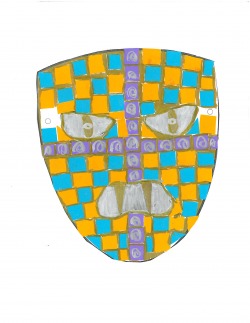
A Mayan mask made by me!
This mask bears a vague resemblance to one that might have been used in ancient Mayan rituals thousands of years ago. Priests would have used it for ceremonies to ward off evil spirits.
A Geographical Map of the Yucatan Peninsula
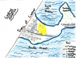
This map shows areas in and around the Yucatan Peninsula, where the ancient Mayan civilization was located. It also shows what the climate was like in those regions, by using pictures to show mountains, desert, rain forest, ocean, coastline, and the Tropic of Cancer. The Yucatan Peninsula was taken up primarily by rain forest, and areas surrounding it were mostly mountainous and semiarid, making them hard to travel. The Yucatan Peninsula's rain forest was partly due to the process of irrigation, or using channels dug in rivers to water crops.
Climate and Terrain
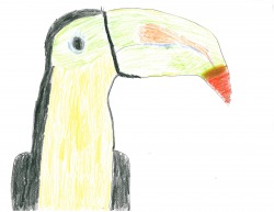
The ancient Mayan civilization was located on the Yucatan Peninsula, which was bordered by the Gulf of Mexico. The climate was hot and humid, with much rain forest surrounding their city-states. There was some rainfall. The land was mountainous in some regions. The Sierra Madre Mountains are some of the largest in Central America, and were located fairly close (in geographical terms) to the Mayan Civilization. There were many semiarid areas, the largest being located in between the Sierra Madre Occitental and the Sierra Madre Oriental. This area is shown in yellow on the map above. Most of the land in the proximity of the Yucatan Peninsula was rain forest, which housed a variety of animals, such as the drawing of a Mesoamerican toucan shown above. On both the Pacific side and the Gulf of Mexico side of Central America are two small sections of desert climate.
The Mayan Civilization was one of the most progressive ever to exist. They found out how to work with the climate and the geographical area, and prospered for over two thousand years.
THE END!
BY AIDAN!
